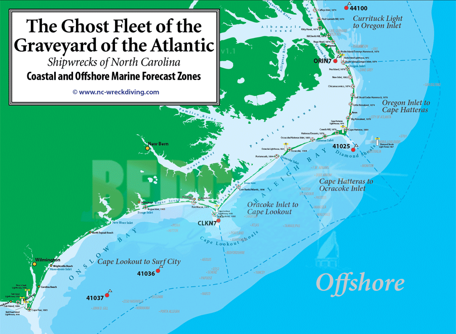
North Carolina Marine Forecast (to 20nm)
ALT 1: Currituck Light, NC to Surf City, NC
ALT 2: Currituck, NC to Surf City, NC
ALT 3: Currituck, NC to Surf City, NC
ALT 4:Currituck Light, NC to Surf City, NC
Analysis: Background Discussion Surrounding Forecast
Offshore Forecast (waters > 20-100 nmiles)
Currituck Beach Light to Hatteras /
Hatteras to Cape Fear
OCEAN Prediction Center
NOAA Tide Tables for NC
NOAA Tidal Current Predictions - NC Coast
National Hurricane Center
Current wind/sea conditions at:
Duck, NC Pier [DUKN7]
Duck, NC Buoy-inshore [44056]
Duck, NC Buoy-offshore [44100]
Oregon Inlet Marina, NC [ORIN7]
Diamond Shoals Buoy[41025] re-activated
t
Beaufort, NC [BFTN7]
Cape Lookout Shoals [CLKN7]
Onslow Bay Outer [41159]
SE of Wrightsville Beach-Offshore [41037]
Frying Pan Shoals Buoy [41013]
Ferry Schedules, Web Cams and Reports (Cedar Island, Hatteras Inlet, N. Topsail Bch., Oregon Inlet, Alligator Bridge)
Current weather forecast for:
Nags Head, NC
Cape Hatteras, NC
Cape Lookout/Morehead City, NC
National Weather Service — Newport/Morehead City, NC
Wilmington, NC
National Weather Service — Wilmington, NC
Sea Surface Temperatures (SST) Gulf Stream & Coastal Waters
Rutgers University Coastal Observation Lab
HotSpots Charts
NC Coastal Ocean Observing System
Wave Height and Direction Analysis
US Navy FNMOC Wave Analysis Model (WAM) Forecast
Marine Prediction Center
|