(this wreck site was previously thought to be that of the W.E. Hutton)
Socony-Vacuum Oil Company, Inc.
Home Port: New York, NY
|
|
| SHIP NOTES: (Sources: Jordan, Gentile) | |
| Name: ARIO (this wreck site was previously thought to be that of the W.E. Hutton) |
Type: Tanker |
| Built: 1920 by Bethlehem Steel Building, Sparrows Point, MD; Hull #4202 | Owner: Standard Transportation Company/ Socony-Vacuum Oil Company, Inc. Home Port: New York, NY |
| Size (ft.): 453-0" x 56-2" x 27-1" | Tonnage: 6,952 gross |
| Propulsion: Oil-fired steam; speed approx 10.5 kts | |
| Date Sunk: 3/15/1942 | Cause: Torpedoed by U-158 |
| Location: Cape Lookout, NC | GPS: N34° 29.990'/W76° 53.879' |
 |
|||
|
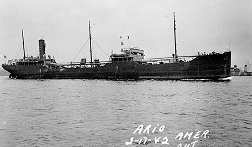
SS Ario (The Mariners Museum via 35)
|
|||
 |
|||
|
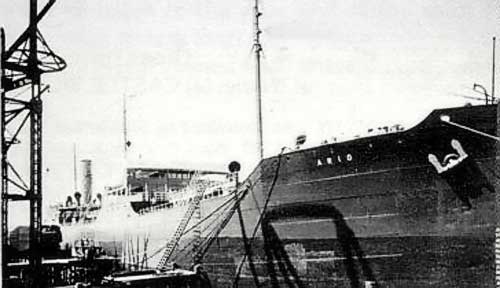
SS Ario (11)
|
|||
| SHIP HISTORY; (Gentile, Moore) | |||
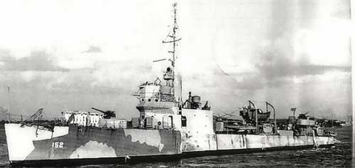
| The SS Ario was sailing alone and unarmed from New York, NY to Corpus Christi, TX in ballast. At 0222 EWT, 12 miles SW of the Cape Lookout Light Bouy, a torpedo struck the #9 tank on the starboard side. Before abandoning the ship, reportedly two subs started shelling the ship from the port and starboard sides. The ship was abandoned but later reboarded by the ships officers to assess the damage and potential for salvage. They determined the Ario was beyond hope and when it was last seen, the Ario was still afloat on its side 10 hours later. It is believed to have sunk just east of Cape Lookout. Eight crewmembers were killed during the attack. The remaining 28 survivors were picked up by the USS DuPont (DD-152) and taken to Charleston, SC. Samuel L. Jeffery was a merchant seaman lost on the Ario. A liberty ship, hull #2997 built by the Todd-Houston Shipbuilding Corporation, was later launched with his name. The liberty ship was delivered on Feb. 2, 1945. It suffered major damage in a collision in the Caribbean on June 1, 1945 which resulted in the death of 4 crew members. The Samuel L. Jeffery was laid up and ultimately scrapped in Port Arthur, TX in 1947. |
|||
 |
|||
|
USS DuPont DD-152 circa August, 1942 (8)
|
|||
 |
|||
|
SS ARIO (The Mariners Museum via 35)
|
|
|
||
| DIVING NOTES: | ||
| Diving Depths: 65-75 ft. | ||
| Current: Slight | ||
| Visibility: Typical inshore viz of 20-40 ft | ||
| Summer Temperature: mid to high 70s | ||
| Points of Interest: Boilers, remains of engine, two bow anchors, steering quadrant and LOTS of tangled metal | ||
| Fish/Animal Life: Generally small fish as the large groupers, etc. have either grown very smart over the years or have become dinner. But, you can be surprised by the appearance of larger animals passing through | ||
| Description: For many years, the Ario wreck site was mis-identified to be that of the W.E. Hutton. This was finally corrected in 2006 by several teams analyzing the wreck but old habits die hard and many folks still refer to this inshore site as the Hutton. To add even more to the confusion, the W.E. Hutton wreck is actually located just off shore and for many decades it was identified as the Papoose. Again, many still refer to it as the Papoose. Confused yet? Well, this all has an even bigger ripple effect: The new wreck "identity" scenario which blows-up a number of decades- other old wreck locations and identifications. This is how it stands today: W.E. Hutton site is really that of the Ario. And the site of the Papoose is that of the W.E. Hutton. So where is the wreck site of the Papoose? In this hypothesis, it is the wreck site previously thought to be that of the San Delfino, well north of Hatteras over 50 miles a way. And the San Delfino? It is the located at the site locally thought to be the Mirlo, another large tanker sunk by the U-117 during World War I. The new location of the Mirlo is yet to be identified. W.E. Hutton — 453-0 x 56-0 x 27-3 — Sunk: 3/18/1942 Papoose — 412-0 x 53-4 x 25-8 — Sunk: 3/19/1942 Ario — 435-0 x 56-0 x 31-0 — Sunk 3/15/1942 San Delfino — 463-0 x 61-0 x 33-0 — Sunk: 4/9/1942 Mirlo — 425-0 x 57-0 x 33-0 — Sunk: 8/16/1918 The Ario is large wreck and is probably one of the most confusing to navigate. This is due to its inshore location and the fact that when it sank, the large vessel became a hazard to WWII navigation and its large profile pieces were wire-dragged/demolished and knocked down to a minimum depth below the water. It is contiguous, but in low viz, the wreck is so spread out and knocked down that unless you are a frequent visitor, even "hunting the edge" can get you confused. And there are few "ship-like" features to help get you oriented. For a first time or infrequent visitor, only the damaged cluster of boilers provide aidentifiable relief to the seemingly low, flat, undefined features typical of the rest of the wreck. But, get it on a good viz day and with the relatively long bottom times, you can start to get a feel for the wreck and how it is laid out. And what seems endless pile of rubble will suddenly seem so large. There are some anchors laying underneath some hull plate at the bow and a steering quadrant on the stern. It is a fun wreck to dive, just relaxing and not having to "chase" the decocompression clock, while gigging some flounder or lionfish for the dinner table. Enjoy it and explore. An occasional shark will frequent the wreck and I have had a "life time" dive on this wreck when a manta ray came along and allowed me to tag along the as it toured the complete length of the wreck from bow to stern and then stern to bow |
|
|
|
| PHOTOS: | |
 |
|
|
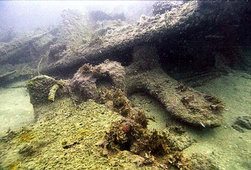
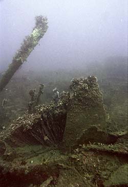
One of the bow anchors
|
|
 |
 |
|
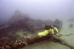
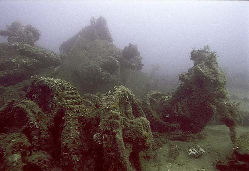
Typical wreck vista
|
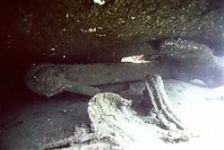
The other bow anchor under hull plate
|
 |
|
|
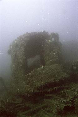
Three boilers all a tumble
|
|
 |
 |
|
Typical twisted debris
|
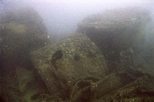
Typical large unidentifiable debris
|
 |
|
|
The bow anchor windlass oblitered
|
|
 |
 |
|
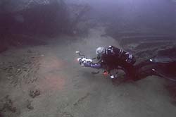
Diver on the wreck edge
|
Remains of ventilator
|

 |